
Weather and Photography by Jane Gough, Melbourne, Australia
May 2nd 2008 ~ Melbourne SE Suburbs.
A surprise little package occurred on Friday 2nd May as an upper trough crossed the State behind a cold front. This triggered a nice little line of thunderstorms across the Metro area as it progressed north eastwards. Not much of a chase, as such, but I grabbed the opportunity to experience it and photograph the back edge of the storms as they moved away.
 |
Thunderstorm Forecast for Friday 2nd May 2008. |
 |
Synoptic Chart for 10am Friday 2nd May. |
Images courtesy BoM.
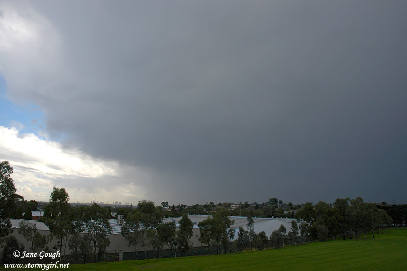
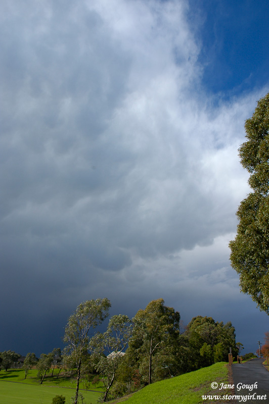
After a lovely sunny morning and a max temperature of 16.2C at 11:14am on my weather station, things began to get interesting as the clouds rapidly developed and it became increasingly darker outside. Small hail and thunder was first reported in the western suburbs around Midday. Rain and pea sized hail began falling here at home just after 12:30pm, shortly followed by the first distant rumbles. The temperature had dropped to 13.6C at this stage. By 12:45pm, the burst of rain and sporadic hail had ceased, and it was rapidly clearing towards my south west. Unfortunately, the storm appeared to increase it's intensity after it had passed me.
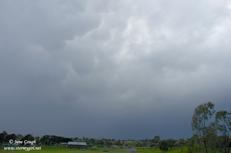
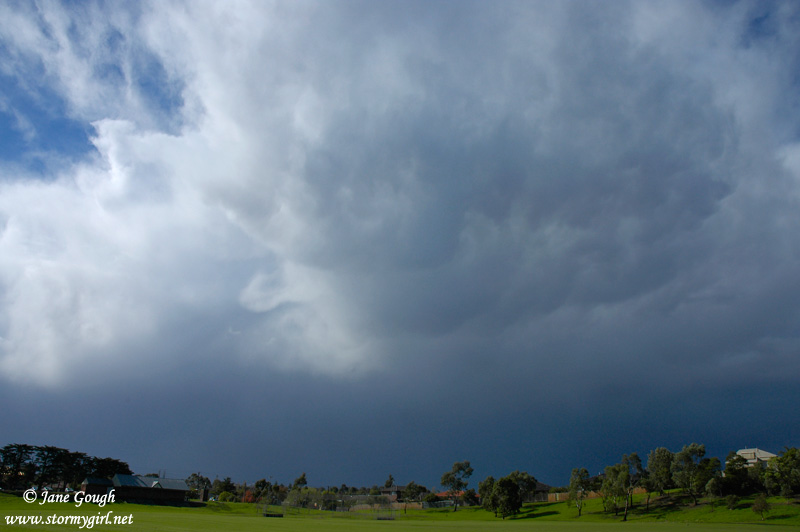
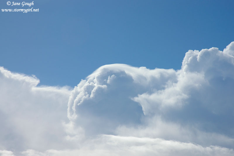
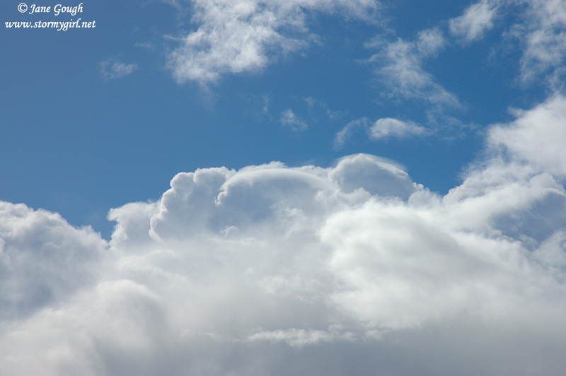
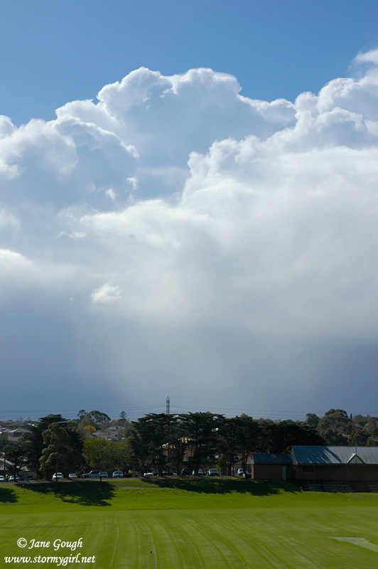
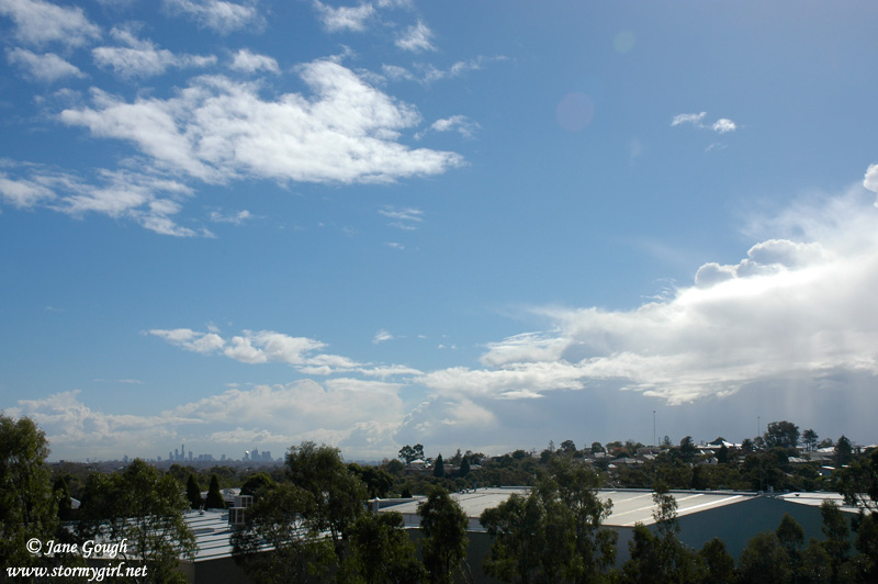
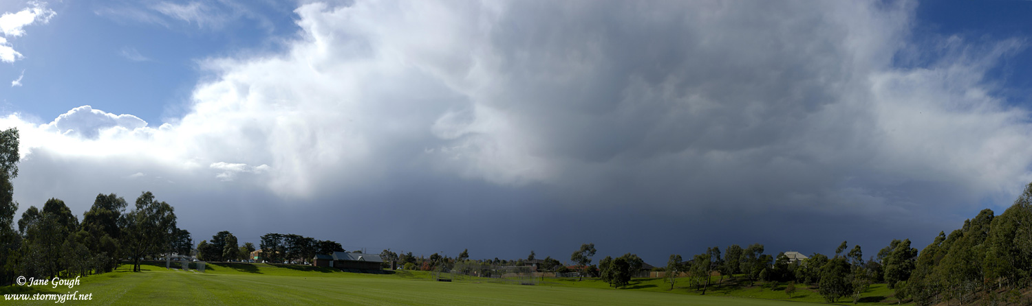
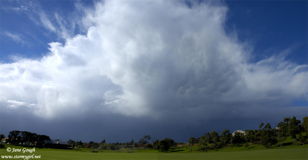
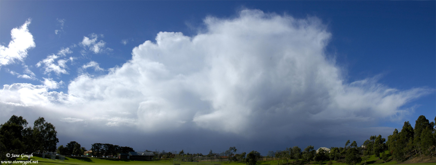
As it had passed and blue sky was approaching, I headed out to a local vantage point with views stretching across the city to the west and through to the north east. Here, I observed several CG's hitting the north east suburbs as the storm continued to rumble. I stayed to photograph the back edge as the sky above me cleared. Weak mammatus developed under the back edge of the fibrous anvil, and I also saw fresh updraughts complete with Pileus (second row of images.).
Unfortunately, I missed out on the majority of the hail and lightning, as it developed just too far north of me. I ended up with a total of 4mm, and a chilly temp of 12.7C during the storm. Some suburbs in the outer east faired a little better with some places receiving near 8mm. There were reports of minor flash flooding and leaf debris in the Croydon area. Certainly nothing severe, but it was fun and quite unexpected, and a chance to air the camera and photograph the structure!


Lightning and radar image taken at 1:30pm |
|
 |
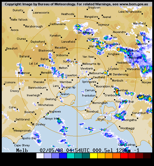
Melbourne 64km radar image at 12:36pm |
 |
The complete radar sequence from 10am EST to 2:54pm EST. |