Weather and Photography by Jane Gough, Melbourne, Australia
November 2nd 2006 ~ Melbourne's Eastern Suburbs.
The Weather in Melbourne has been a real mixed bag over the last couple of months. October is usually our wettest month, but proved to be one of the driest October's on record, and I recorded a measly 8mm when the usual should be around 70 - 80mm.
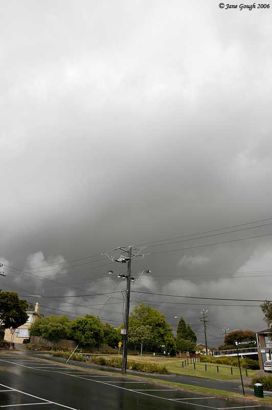
A trough was due to cross Victoria and bring widespread rainfall, and the prospect of thunderstorms! Considering it has been months since a decent storm and rainfall I was beginning to get a little excited!! The rain began falling overnight, and I recorded 5mm (almost surpassing my total October reading!), and throughout the morning the cloud band thickened and brought constant rain for most of the morning.
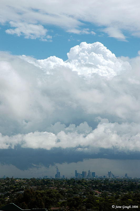
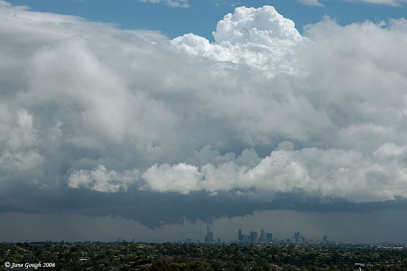
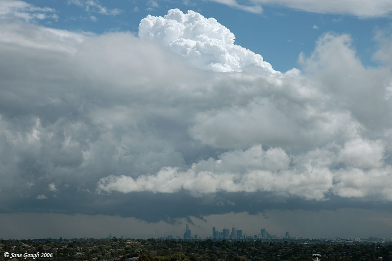
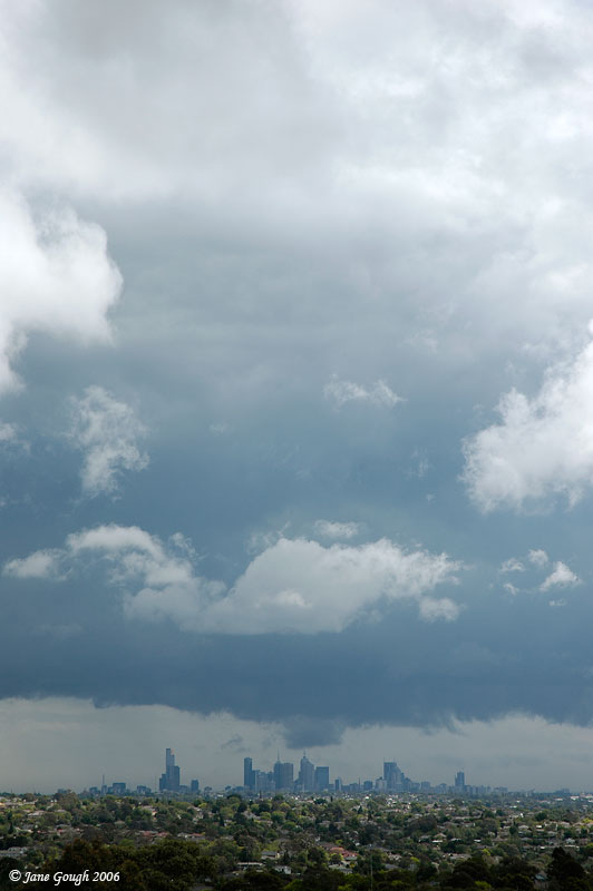
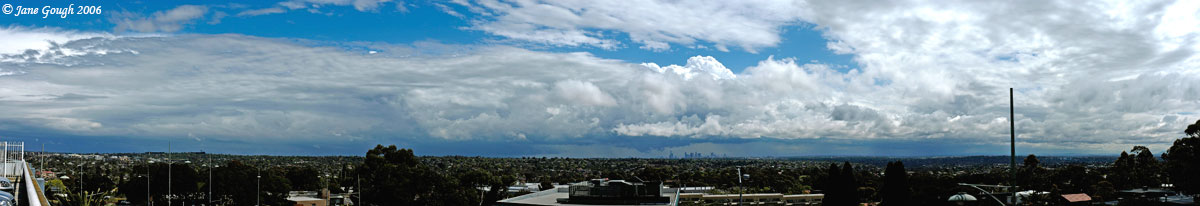
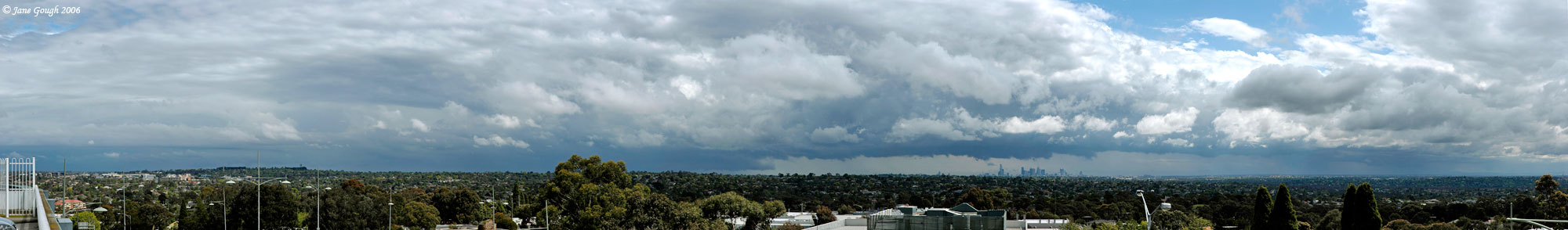
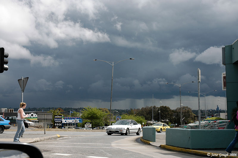
As the cloud band retreated East and the sun broke through I could see on the distant Western horizon a line of forming towers! I checked the radar image and noticed a line forming just west of Geelong. I grabbed my camera gear and headed up to Doncaster Shopping Town rooftop car park to watch the line develop over the city and slowly head towards me! Unfortunately there was quite a lot of mid level cloud streaming in obscuring my view of the crispy updraft, but managed to take a few images when I could. I was also interested in the base features swirling above the city!
-----------------------------------------------------------------------------------
TOP PRIORITY FOR IMMEDIATE BROADCAST
SEVERE THUNDERSTORM WARNING - MELBOURNE AREA
for DAMAGING WIND and FLASH FLOODING
For people in the Eastern, Northern and parts of the Inner, South East and Outer East Local Warning Areas.
Issued at 3:27 PM Thursday, 2 November 2006.
The Bureau of Meteorology warns that, at 3:30 PM, severe thunderstorms were detected on weather radar near Greensborough, Ringwood, Scoresby and Belgrave. These thunderstorms are moving towards the east to northeast. They are forecast to affect Hurstbridge, Whittlesea, Lilydale and Yarra Glen by 4:00 PM and Kinglake, Healesville, the area south of Healesville and the area east of Healesville by 4:30 PM.
Damaging winds and very heavy rainfall leading to flash flooding are likely.

Above warning and image courtesy of the BoM.

Radar loop courtesy BoM and Strike One.
-----------------------------------------------------------------------------------

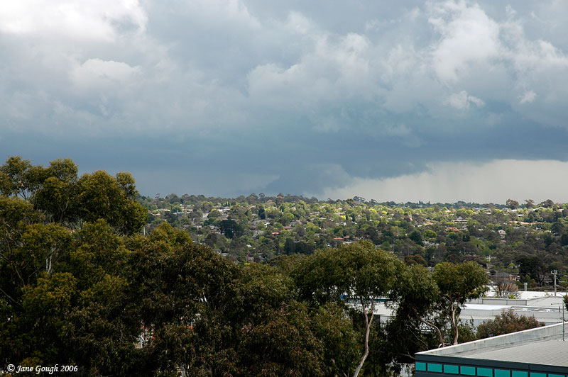
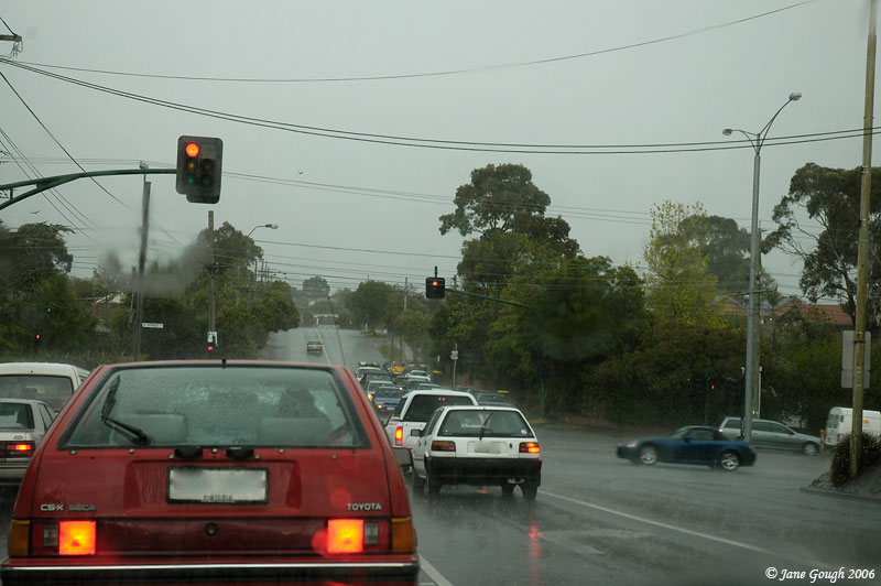
I left the car park after about 30 minutes to intercept the line towards the South, and upon leaving the rain began falling from the base in the distance.
Driving through Box Hill it was apparent that the line was ever encroaching and I was soon going to experience a deluge, one of which I hadn't driven through for what seemed liked years! The huge drops began sporadically, but then the heavens literally opened up and I was soon surrounded by water covering the roads and the drains completely over flowing. What a sight!
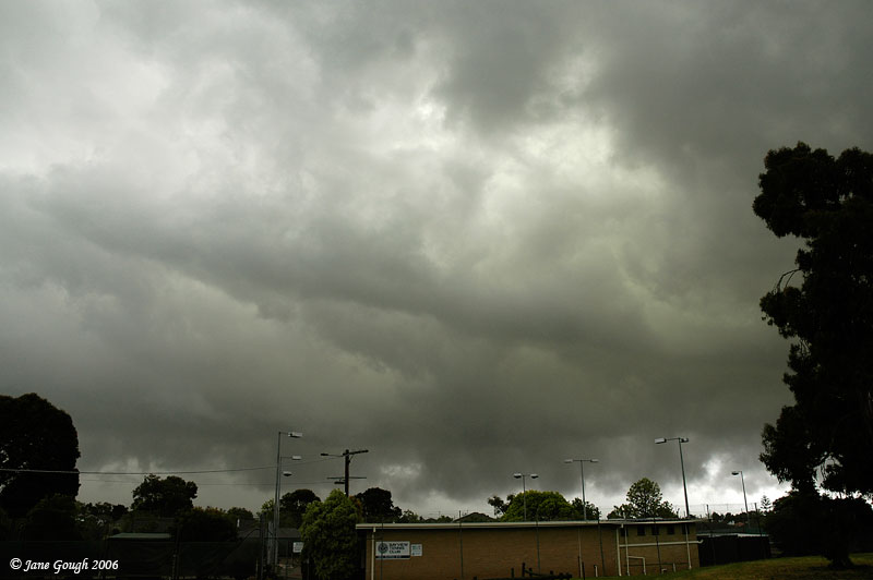
The rain eased off slightly and I drove to a sports oval in Chadstone which has good views towards the West, and photographed the base overhead before the torrential rain began again.
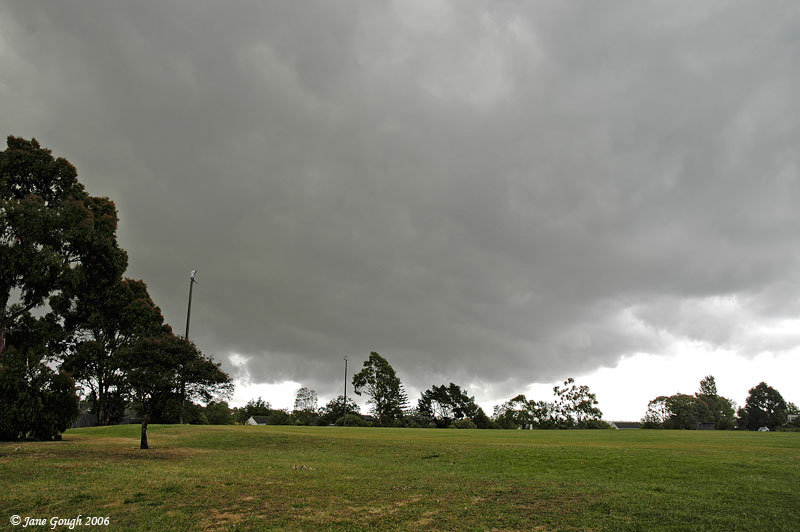
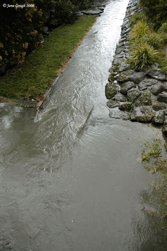
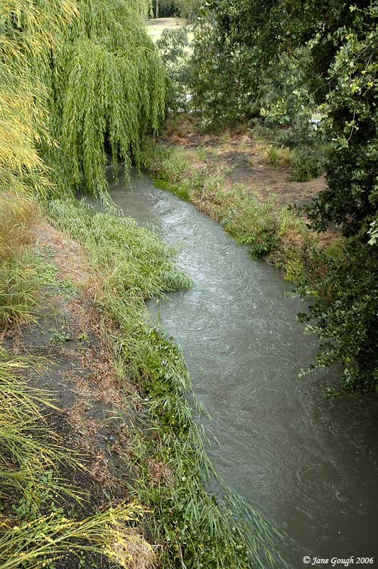
I then drove through the deluge to Scotchmans Creek in Oakleigh which is notorious for breaking it's banks in a sudden downpour. I could hear static on the radio, but failed to see any lightning or hear any thunder....the roar of the rain took care of that!!

I photographed the back of the line and drove out to Glen Waverley to try and fine some lightning, but to no avail. All in all, a fantastic 2 hour chase around the Eastern Suburbs and experienced some wonderful welcome rain, 22mm recorded at home for the whole event, with the maximum rainfall rate at 82mm/hour at 2:55pm while I was driving through it!